


Ride to the Rockies, Day Two
The temperature had dropped overnight, so I got on my cold weather gear for my early morning departure, with my destination the TAT-Shak, a rustic cabin maintained by another ADVRider for fellow “inmates' of that forum and riders of the Trans America Trail, yards away in the Ozark woods.
I had planned on jumping on the Interstate for a little while just to get past the sprawl and downtown of Birmingham, but I missed the turn Ken had told me about. Instead I shot through early morning downtown Birmingham on US 78 before the city had awaken and sailed out the northwestern edge, headed for the flat delta of Mississippi and Arkansas, leaving the dwindling Appalachians in my mirrors.

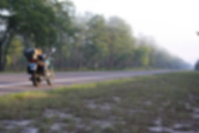
Last of the Appalachians as I head west approaching Mulberry Fork leaving Birmingham behind
I did manage to get onto I-22 for a short while, where US 78 joined it for several miles, only to leave again and intersect with US 278, which ran more westerly into Mississippi. That route allowed me to miss Tupelo and offered views of cotton fields on all sides. Before Clarksdale, I opted for a little squiggly gray line, MS 316, to connect with US 61/49. Although I was flying across the flat, rich bottomlands of the Mississippi Delta, the road swept left and right in surprisingly tight curves. US 49 carried me across the Mississippi River and into the Arkansas and the West, my second only bike excursion beyond that wide and muddy divider.
US 49 continued west then north and I followed it to AR 17, hopping up to AR 38 for the run west almost to Interstate-like US 67 that poured itself into Little Rock—another metropolis avoided. I hopped north again on AR 31 to US 64, which carried me most of the res tof the way west for the day.
Crossing I-40, I headed north on AR 105 to 164 to the famous scenic AR 7 toward the TAT-Shak. Closing in, I turned onto Old Highway 7, which quickly became gravel. I figured I must be getting close and kept one eye on the road and one eye on the GPS until it said I was there. All I saw was forest lining each side of the track. I rode farther along, still seeing no signs of any shack or even drive running into the woods. I looked at my last of ADV contacts and, of course, my TAT-Shack host was the only one not there, besides I had no signal at all on my cell phone and it was getting late in the afternoon and deer became a concern if I did not find it soon. I ran back to highway 7 south, then turned west as 164 headed toward Hagerville, keeping my eyes peeled for signs of the shack. I could swear it should have been there somewhere past the curve that met up with the Ozark National Forest, but I saw nothing.
By then the sun was approaching the horizon and the trees were already offering twilight beneath thiier branches. I headed back south on 7, hoping to pick up a cell signal, so I could check the Internet and GoogleMaps for another look at the location of the shack. It wasn't until I got back to I-40 that a signal appeared and I pulled into a Best Western to take a look. I had been so close, having ridden the wrong end of Old Highway 7 and having passed the other end on 164 a couple times, but by the time I'd stopped to check, darkness was almost upon me and I knew I'd be dodging deer by the time I got even close to the shack, so I admitted defeat and booked a room at the motel.
So far 1,150.6 miles


