


Ride to the Rockies, Day Twelve
I woke to rain the next morning, trying to snooze it away but it persisted. The Rainy River was living up to its name. I guessed I should just be thankful it was not called the Snowy River. The tent got packed away wet.
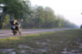
At Pelland, I continued east on US 71 to International Falls, while highway 11 turned south.
Arriving in International Falls, downtown I spotted an open diner. I rode a little way past to see what other options I might have but seeing none I did a U-turn and parked up in front of Coffee Landing Cafe. On the menu cover it was described as a “small town cafe with big city espresso bar.” The place had a wide selection of coffees, but I opted for the brew of the day, good old black strong coffee. With the cold rain I had ridden through the hot coffee was marvelous and I treated myself to a real breakfast of an omelet with onions, green peppers, black olives, and feta cheese. It was very good and came with toast and unlimited coffee refills, all for less than $9. There was a broad selection of other mouth-watering sounding omelets and other breakfast and lunch fare. I highly recommend the diner if you ever find yourself in the area. You'll find great food and likely encounter a diner full of friendly locals and tourists.
While enjoying my breakfast the rain let up, but one of the friendly waitresses announced that to the west was a storm coming our way with tennis ball-sized hail. I thought I'd better leave and try to stay ahead of the storm so I wolfed down the last of my coffee and paid my bill. I could ride 60 miles per hour and even a fast moving storm would probably only do 30-35. It turned out my decision was a good one as I found myself riding on southeast on US 53 and out of the rain with the sun coming out as the temperature rose.
At Angora I topped up my fuel, even though it took almost nothing to top up, because I was turning off on MN 1 to the east and eventually southeast through the wilderness of the Minnesota north woods to arrive on the shores of Lake Superior just above Silver Beach—a distance of 115 miles. At 1 I peeled off toward the east and into the woods. As the day warmed and the sun came out, and all my larers of clothing were heating me up. I thought about removing a layer or two, but was afraid I would regret it when I got near the cold waters of Lake Superior. At Ely 1 took a southeastern course toward the big lake. About 26 miles on, MN 2 offered the opportunity for a shortcut directly south to Lake Superior at Two Harbors, but I opted to stay on 1 so I would have more of the lake's shoreline to ride to Duluth. As I rode over the last couple ridges before arriving at the coast I cold the feel the temperature plummet ten degrees as I topped the hills then climb again as I dropped down on the other sides until that last drop down to the lake.

Lake in the North Woods of Minnesota on MN 1
While MN 61 promised to be a beautiful ride along the north shore as it hugged the beaches, with occasionally inland forays before returning to Superior, but as I approached and the temperature dropped the lake was hidden under a deep veil of fog. I turned right onto 61 and with a grey blank to my left and tourist destinations on the right I rode southwest. As the road would leave the coast more a mile or two, the temperatures would climb and as it returned to the lake they would drop. Not being able to see the lake and left with only the touristy shops on the highway and the tourist on the increasingly crowded road, I could have taken the shortcut on 2 and not missed much.

The "view" of Lake Superior with fog settled in up to the bank

I took a little hike along here hoping for a better view of the water.
The fog lifted very slowly as I headed toward Duluth, with it occasionally backing out to sea a quarter mile then returning right up to the shore below the bluff I was riding along. Just before a tunnel appeared ahead, I turned off to the parking area of the Silver Creek Cliff Wayside Park where part of the Gitcheee Gami State Trail wound along the lake shore. I parked up and got off the bike, hoping that a hike down the trail might provide a better vantage point with less fog for a photo or two. I walked along the path that trailed along the cliff, through which the highway tunnel bored, but the fog did not cooperate. Still, it felt good to get off the saddle for a bit and stretch my legs. After a half hour or so I walked back and climbed aboard, pulling out onto 61, negotiated the tunnel, and soon passed Two Harbors. The Go Pro had been turned on when I had first got on the coastal highway and was recording more and more and more of Lake Superior as I rolled toward Duluth and the fog lessened when I flicked the shutter occasionally when the scenery seemed to deserve recording.
The sore throat I had worried about a couple days ago had gone but was replaced by an incessant sneezing. I would feel one coming on, grab my chinbar, throw it open, left one fly, then close the helmet again. It was unnerving to be blind for that split second when my visor was up and I was letting one go.
By Duluth the fog was gone and the heat was up. I stopped at a McDonald's and removed all my inner layers and got a cold drink and a bite to eat. I checked the Aerostich website, as I had wanted to stop by while I was passing through and had been looking forward to it for a while, even though the most I could afford to buy were a couple of zipper pull repair parts. The website had given their hours and days that they were opened. That's when I realized it was Sunday and they were closed.
Disappointed that I wasn't going to be able to visit Aerostich I made my way through Duluth, after a couple wrong turns and back-tracking, and into Wisconsin. I caught US 53 in Superior and left the Great Lake behind me as it trended south through Wisconsin and became almost Interstate-like as it approached Eau Claire. I bailed off the big highway at Chippewa Falls, heading east on WI 29 several miles then south on WI 27.
I had heard good things about southwetsern Wisconsin, and I had come this way so I could see it for myself, if only a small part while passing through. My other goal as I rode south was to get on the lower half of the map before stopping for the night, so that getting to my friend Joe's the next day would be easier and shorter.
The landscape changed to beautiful rolling wooded hills, very reminiscent of Kentucky. The roads became windy and I understood the appeal to motorcycle riders of this part of the country. I was glad I took the time to pass through it.

The Kentucky-like hills of southwestern Wisconsin
I got onto the bottom half of my map, but it was fast approaching sunset. I spotted two deer, one of which crossed the road in front of me. I was ready to stop and worried about deer only getting thicker as night approached. I couldn't find campsites, which had been so prevalent farther north. Finally, I stopped at a station to fill up and asked about camping. I was told there was a campground ahead at Leon. I found the campground less than a mileeast of the main road called simply Leon Valley Campground. I rolled in, and not seeing anyone at the office, I picked a spot among the RVs parked on a hill across the road from a pool. Soon a golf cart rolled by and one of the owners got out to tell me that my spot was generally for RVs and that there was another area for tents, but as it was late and they probably would not need the spot for anyone else, I could stay put.
Hoping my tent, which had been put away wet that morning would dry before I went to sleep, to kill some time I headed back out to the corner on the main highway where I had turned where there was a small local tavern. There was a Blatz sign out front, a beer I only remembered from my days when I was young and living in Michigan. I went in and asked if they really had Blatz. They said they surely did and so I asked for one. And it tasted just like I remembered. Beer up North seem to taste better to me, and my unscientific theory is its the water they use to brew it up there, as opposed to the brands we have in Florida which are generally brewed in Atlanta or further south. I had another beer while talking to the local fellow next to me about riding and about southwestern Wisconsin.
It was dark when I left for camp, so I rode very slowly and carefully, expecting encounters with deer around every corner, but I got back unscathed and to a relatively dry tent. I tried to call home, as I usually do each night to let my family know I am off the road for the night, but I had no signal in that little pocket among the hills where the campground lay. I went to sleep looking forward to seeing my old friend and having a day off the bike the following day while Joe took a day off work.
Miles so far 5,850.8


