


The Ride I Didn't Take
When you are closer to the end of life than the beginning, you tend to look at things differently. You no longer dream of what you will do in the future. Instead, you contemplate your dreams, wondering how many of them you can fit into the time you have left and how to do that.
Fifty-six years have come and gone, and although I've had adventures in my youth, sailing boats and visiting exotic places, I now realize how many places I have not seen and how little I've done. Although time has always been ticking away, I am suddenly, it seems, acutely aware of it. What seemed could be put off forever, doesn't seem so anymore. I calculate how many years are left, and even more importantly, how many good years are left—years when I will still be able to physically do the things I would like to and ride the places I've dreamed of.
After my adventurous youth, I settled down to home and family life, fitting in a riding trip now and then for a few short days, perhaps a week, then quickly returning. As my kids grew along with my love of riding so did my dream ride list—one of these days, when the kids can be left alone, after school has started. When the kids are in college, I think, “How old will I be?” The answer comes back, “Sixty-two when my son goes; sixty-five when my daughter does.” “When they are out of college, I'll be close to seventy, I tell myself. “When am I going to ride those dream rides if I don't start now?”
With the truth of my mortality vividly in mind, I finally decided to make take a stab at whittling down that list of rides. “This one was going to be epic,” I told myself. Even though it would be only a bit over two weeks long and not cross a continent, it would be a start. As the kids grew older and I could be away longer, I could slowly stretch out my wanderings, but for now this would do.
Just after I graduated from high school, I had taken a trip with my dad. It was a journey I would remember bits and pieces of for years. Those memories would prompt me later to set out on other adventures. We had not really travelled far, just a few hundred miles from our home in southwestern Michigan to the Upper Peninsula and Mackinac Island, to Taquamenon Falls, then along the south shore of the peninsula to Wisconsin, and finally a ferry ride across the great Lake Michigan and south to home. I have always wanted to return and recapture at least some of those memories of misty fog and pine trees, long stretches of deserted beaches, cold air rustling tree limbs, tannin tinted waterfalls, and glacier deposited boulders.
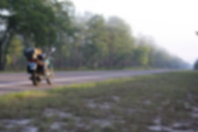
I now had a suitable bike for a lengthy journey, having outfitted my 2011 Triumph Bonneville with a touring saddle, a tail rack and bag, a tank bag that doubled as a map holder, and a versatile set of soft panniers with top bag. I even had rigged my automobile GPS onto the handlebars to back up the paper maps. While not capable of super long stretches without refueling, the Bonnie had much longer legs than my old CB350, which required fresh fuel every hundred miles. On the Bonnie I could stretch that out to over a hundred and forty, if need be. I had also mounted two MSR fuel bottles, thirty ounces each, one on each side of the bike on the passenger peg struts, giving me an emergency supply for another twenty miles or so, and doubling as fuel for my miniscule camp stove.
As I planned my escape, studying map after map, the ride grew. Instead of heading north-northwest to Michigan, I would make this a multiple destination ride. If you drew a line due north from our home in Central Florida, you would eventually pass very near my brother's place in Inman, South Carolina, just fifteen miles south of the border of North Carolina and its magical roads. Tim had just gotten a new bike, too. I could ride up and join him for some spirited riding north and slightly east across North Carolina, into Tennessee, sweeping through the western tail of Virginia, and into West Virginia, taking US Route 52 along the east side of the Sandy Rider that, flowing north, empties into the Ohio. That would be a pretty easy day's ride and we could camp just before the Ohio River crossing. The next day Tim could return home and I could cross over, finishing phase one of the three phase ride.
After a short ride along the Ohio River I would head northeast across the farmlands of Ohio and Northern Indiana arriving at the start of phase two, at South Bend, Indiana. This would give me a chance to meet up with old high school friends. From there, I would have to go north to get to the UP, so what better way than to make phase two a scenic ride along the eastern shore of Lake Michigan, camping two-thirds of the way up, near Traverse City, before a final run hugging the coast to the Mackinac Bridge via the “Tunnel of Trees,” also known as Michigan Route 119. A ride across the big bridge and arrival at Taquamenon Falls State Park would complete phase two and be the jumping off point for phase three—the main event.
Phase three would not follow the south shore as the trip with Dad had, but would run as close as possible along the north shore, with a first day stop in Houghton, on the Keweenaw Peninsula. From here it would be a quick hop up to Copper Harbor at the tip of that peninsula then a run west to Duluth and northeast to Two Harbors, where camp would be made, on the north shore of Lake Superior. From there I would run into Canada, stopping at Nipigon for the night, then on to Wawa for the next night, crossing back into Michigan at Sault Saint Marie. With Lake Superior circumnavigated, the third and last phase would end and I would high tail it back south to Florida over the next couple days.
This ride would only last fourteen days or so, not epic by many adventure rider standards, but a good beginning on filling the rest of my life with bigger and better adventures. It would be my longest ride so far and pass through three areas I had wanted to explore for a long time. For me that would be epic and I would pass from being an observer of other true adventure riders' ride reports, which I had followed so many times on advrider.com, to being an adventure rider in my own right. It would be a great beginning.
But then it all went to hell. All along I'd been plotting and planning, working out when the income would be coming in as a result of some good business months during the first part of the year. My target was mid-May. This would enable me to get back, with a couple day buffer in case I was delayed, before the kids got out of school and I went into my annual daycare duties period, which would last until mid-August. As the time approached, finances improved. After a long period of poor sales, a much better stretch of months followed. With time from sale to payment stretched out 120 days, in the midst of good sales our income was miniscule, but it was improving as May approached and the good months finally should pay off. I figured up bills for the time I would be gone and estimated what would come in to cover them. It looked good...until the last moment, when I realized I had estimated inaccurately, and although the funds would cover bills there would not be nearly enough to cover fuel and expenses for my two week ride.
Depression set in. I felt trapped without some kind of release before the hassles and stress of managing our two children for the summer would begin. Even in bad years, I had always managed to get some kind of extended ride in before summer. I had always somehow arranged a fall ride after the summer had passed and a ride in the spring before summer arrived, but now my long anticipated epic ride was not going happen. The dream was dead.
I stewed as the time I would have left came closer and closer. I took a deep breath and weighed my options. An epic ride was now out of the question; it would not be same, but I could manage a frugal week on the road. I had already promised my brother that we would ride together and with him being only six hundred miles away meant that could still be done. I could be there in one day. Staying at his place would not cost me anything. Tim, being informed of my situation offered to pay for our night together while riding. Now that I was not heading to Michigan, there was no need to follow my original plan. With the Blue Ridge almost at his back door we could explore any of it we wanted without having to travel far.
The Approximate Route

So, disappointed in my plan's failure, I packed the bike knowing I would at least get some good mountain riding and camping in before heading home for the summer. The Bonnie and I were ready for leaving by my original departure date. Early in the morning darkness we rolled out of the drive, with the LEDs parting the darkness in front of us, we roared northward.
The plan was to get north on US Highway 27, past Ocala, and onto US 301 into the Florida countryside long before all the traffic, that usually made passing through Lady Lakes and Ocala, so slow and difficult, had filled 27. The plan was successful and 301 was clear as I sped through the flat North Florida landscape and into Georgia's piney eastern woods onto US 1, where the usual woodsy smells of Georgia bought back memories of earlier trips through this quiet corner of the United States. With only an occasional car or logging truck as company, I avoided all but the smallest towns and eventually reached US 25, which I would follow to Augusta's by-pass and into South Carolina. Here I took familiar country roads zipping north on an intercept course with Interstate 26. From there, the ride on 26 was fast and brought me to Exit 15, just short of the North Carolina border. Turning west on Asheville Highway, recrossing I-26, and taking the second left onto a small side road I wound my way to the dirt road that ran across an incredibly steep railroad crossing followed by a hard right. From there the little path curved left through the woods and into an opening ringed by forest. At the back, in a small bay in the woods, lay Tim's place, perched above a forest stream.
I had been up here before, by car, with the entire family. The kids could not be dragged from the creek in which they incessantly panned for gold, which turned out to be mica. It was a little bit of heaven, not far from his and his wife's employment with all the conveniences of larger cities like Spartanburg and Greenville, but also minutes away from the expanses of the beautiful and quiet Blue Ridge Mountains.
I was early so I took the short hike to the creek,hoping I might scare up a deer on the way down the wooded, shadowy path. The recent rains had swelled the creek to about twice the depth it had been last time I was here, muddying its usually crystal clearness with the load of foothill mud it was carrying. I made my way back up the hillside to the house. It was not long before the crunch of tires on the gravel road told me Tim and Pam were on their way home from work. Hellos were offered along with cold beers.
Over steaks on the grill, the planning began for the next couple days' ride, with Tim on his new Star Stratoliner and me on my Bonneville. It was now Thursday night and Tim had a friend coming on Sunday. Together they were flying to Chicago on a business trip with an early Monday morning departure, so Tim had to be back by Sunday afternoon. We could ride out for a day, camp somewhere, then he would return on Sunday morning while I would ride on alone.
There was no need to ride to West Virginia as originally planned, so we studied our options. I had ridden a lot west of a line drawn between Inman and Asheville, so we looked further east for interesting destinations. I had once ridden east on the Blue Ridge Parkway on the second Motorcycle Kickstart Classic out of Maggie Valley with the folks from the Wheels Through Time Museum and staff from Road Bike and American Iron magazines, ending at Denton for a huge Antique Motorcycle Club of America meet. It was glorious riding among the 75 running antique examples of the best two-wheeled transportation America, Europe, and Japan had ever produced. On the way, we had passed Mt. Mitchell, the highest point east of the Mississippi, but had zoomed right by the access road winding north from the BRP. Mount Mitchell looked perfect as a first stop and we could ride the area east of Asheville on side roads on the way up, past impressive Chimney Top Mountain and around Lake Lure which is tucked neatly among the surrounding mountains. The route chosen, we hit the hay, but there was no need for an extremely early start with the mountains so near. That was a luxury for me because I was accustomed to leaving in the darkness of early morning on my other trips from home, with usually hundreds of miles before the next stop.
Upon waking, fresh coffee was waiting along with a hot breakfast. We said good-bye to Pam as she left for another Friday at work, while Tim and I remained behind to load the bikes and get ready for our ride.
Tim took the lead back down the dirt road, across the tracks, and out of Inman. Within fifteen minutes we were in the open countryside rolling toward Lake Lure with the mountains looming ever taller as we sped north. Following NC 9, soon Chimney Top was visible ahead as we veered west around Lake Lure's water, twinkling in the early morning light. We passed through the little town in the shadow of the towering mountain and its rock pillar, looking like a sentry post overlooking the valley. Now the rolling countryside was behind us and we were climbing in the mountains. On one of the first curves, I eased the throttle, slowing in an attempt to catch a better view and to point out to Tim the wild turkey scrambling up the side of the hill through the trees, trying escape us. Throttling up again we continued, turning east at US 70, and found our way to NC 80, our connecting road to the Blue Ridge Parkway. Route 80 rivaled many of the other highly touted riding roads in the area, but escaped the crowds many of those roads attract. The twists and turns of 80 provided the kind of riding I revel in and didn't let up until it deposited us onto the BRP. This was a great start to the trip and instead of regretting what I had missed, having had to dump my epic ride plans, I started to appreciate the pure pleasure of the present.
We backtracked west on the Parkway for the few miles to NC 128, the access road up to Mount Mitchell, and wound or way north into the clouds and thinner air. We stopped at the parking lot just below the summit and dismounted to give our legs a workout on the walkway to the peak, at 6,684 feet. With our eyes satiated by the views of the surrounding mountains, it was time for our hunger to be treated likewise. We had followed a group of bikes on our way up. They had turned in just before the peak into a parking lot of the State Park restaurant. On our way back down we decided to give it a try. I expected the fare to be uninteresting and overpriced, given the location, but was pleasantly surprised by the reasonable prices and fair selection, not to mention the spectacular view out the wall of windows, apparently perched in space with nothing but air and mountains far below in view.
Atop Mount Mitchell

We hadn't planned what we'd do after visiting Mount Mitchell, so over lunch we discussed our options. When we had been visiting Tim before with the kids we had run over to Devil's Fork State Park on Lake Jocassee, in the northwestern corner of South Carolina. I remembered the unique camp sites there, set up on mini terraces in the woods overlooking the lake. We could head west from where we were and come down the west side of the lake through an area filled with waterfalls. I would be quite a haul to get there, but plenty of other opportunities were on hand along the route if we would decide to stop short of our afternoon goal. At Brevard, was Davidson River Campground, where we had camped with the family, in a perfect spot for us should we halt short.
Now with a plan laid and our energy replenished, we headed west on the BRP, past Asheville, and on to the southern dip the Parkway makes before heading northwest to its terminus in the Smoky Mountain National Park. Just past the southern point we turned south on NC 215, a road both of us recalled riding a couple years earlier which provided some of the best riding in these mountains. Taking 215 south would get us to US 64 where a turn west would take us in the direction of Lake Jocassee or a turn east would take us to Davidson River.
We would need food for the evening at camp, whichever we chose. Looking at the map, it did not look likely we would find that on our way to Lake Jocassee. We decide to run into Brevard, where we knew we could pick up the evening victuals, then head west again and go on to Devil's Fork if we had time. At Brevard, we found the large Ingles we remembered from our previous camping trip here, and filled up on dinner, snacks, and beer. Then estimating our remaining time until dark, we retraced our route west passing NC 215 and continuing to NC281 south, which would lead to the South Carolina line. From there the route was renamed SC 130 and wound south to the Cherokee Scenic Foothills Parkway, or SC 11. On 11 we headed just a few miles east before turning north again, up into the hills surrounding Lake Jocassee and to Devil's Fork State Park. We pulled in, only to find out there were no camping spots left, this weekend being one of the first nice weekends of the camping season. Disappointed, we turned around but remembered a sign on the way in saying, “Camping.” Not far from the park entrance, we spotted the sign again and crunched onto the gravel parking area. They had bunches of travel trailers in the park, apparently parked there year round as vacation homes for the summer season, but almost all seemed vacant now. We were the only campers it seemed, and we were offered a spot for a whopping eleven dollars. We were sold. We remounted our bikes for the descent down the steep rutted dirt road to our site, which was luckily near the top of the hill, and surrounded by tall hickories on a more or less level terrace set above a wooded hillside.
We set to work setting up camp. The tent was set quickly, then filled with our sleeping bags and pads and the stuff we might need overnight, while we enjoyed our first beers of the day and the darkness settled over the woods. It woudn't be camping without a camp fire, so Tim gathered deadfall while I pitched the tent and by the time I had finished he had built a fire which was soon blazing. I covered my bags on the bike in case of overnight moisture. Tim pulled up a log and I mounted my handy tiny hiking three-legged stool and we sat there staring at the fire, breathing the smell of the woods and the smoke of the fire while Tim dined on the fried chicken and I on my Italian sub we had picked up back in Brevard, washing it down with more beer. The night soon enveloped us and we shuffled off to the tent.
In the night rain came, tapping on the sides of the tent beside my shoulder. I moved so I would not touch the inside wall and get wet myself from the moisture wicking through the tent fabric and was glad I had a inflatable pad under my bag. If rain made it into the tent, even a little, there would be no joy sleeping in a bag while the water saturated it. The Thermarest pad ensured that would not happen. I drifted off to sleep.
In the dim light of morning, I woke to continuing rain. We were in no hurry and so I rolled over to rest a bit longer, listening to the tap, tap, tapping of the rain dripping from the sky and off the leaves overhead onto the tent. I heard Tim stir, unzip the tent door, and step outside into the rain. I closed my eyes hoping to get more rest, if not sleep, and hoped that soon the rain would be gone.
It wasn't long before most of the rain I could hear was only dripping from the trees, so I, too, shed my sleeping bag and stepped out into the still early morning. The sky through the trees was overcast with gray and it was looking like the rain was only taking a break and would soon be falling again. To my surprise, when saying good morning to Tim, he told me when he had gotten up out of the tent he was greeted by a very large brown bear twenty yards from the campsite, down the little wooded galley, coincidentally the area where he had been tossing his chicken bones at dinner the night before. I was disappointed that he had not gotten me up when he saw the bear. He had thought I was still sleeping and had not wanted to disturb me, but I would have like to have gotten a look at that big visitor. By the time I had popped out of the tent, though, he was long gone.
I got out my Dragonfly camp stove, for the first time other than its test run. I got one of the two MSR bottles I had mounted on the passenger peg brackets, removed the cap and replaced it with the stove valve, pumped up the bottle, let a little flow into the burner, then lit that, allowing it to heat the burner. A moment later I opened the valve, got a working flame, and placed the little pot of water on top in preparation for a breakfast of tea bag coffee and instant oatmeal. This little stove was very practical, set up easily and stowed small. It produced a flame that would boil water at least as quickly as the burner on the kitchen stove back home. It ran on unleaded gas, allowing the fuel canisters to do double duty as both cooking fuel and spare fuel for the Bonnie.
Breakfast at Our Lake Jocassee Campsite

Hot food inside us now, we packed up camp, stowing all our gear in the big bags and rolling up the wet tent and strapping it fore-and-aft along the shelf formed by the intersection of the top and side bags. The three legged stool was secured the same way to the opposite shelf. All packed and ready to go with the rain covers still on the bags, we weighed our options.
Rain looked certain for most of the day, and Tim had to return to Inman at the end of it. We decided to head back towards Inman, but first going north back into North Carolina, then east toward Tim's place by way of US 64. If the rain relented, there were plenty of interesting side roads to explore, and if not we had a fairly straight and quick shot back to Tim's, where I could stay another night, avoiding camping in the rain.
We rode east first until we spotted US 178, where we turned north toward the state line, just before which was Bob's Place, a little bar on a hairpin Tim and I had visited before because it reminded us, more or less, of Fuzzy's back home. We zipped past Bob's this time and entered North Carolina again. At US 64 we headed east, passing through Brevard once more. We were right about the rain, and it came and went all day. We stopped at a McDonalds to get some food and to take advantage of the free WiFi to check the weather radar. After watching the animated radar that offered no good news to us, we made a decision; we would ride directly to Tim's and get out of the rain for the rest of the day. We found US 176 in the road congestion of Hendersonville and peeled off to the southeast toward Inman. After a few miles we were riding through quiet mountain countryside again. After passing US 25, the highway began to twist and turn its way southeast and the sky lightened a bit. Soon, after a long downhill grade, we crossed a river and could see to our right an old, no longer used bridge with a turn off and a parking spot on the far side of the river. We took advantage of this spot and rolled up just short of the old bridge, parked, and dismounted for a short break. We walked around the large concrete barriers, intended to keep vehicles off the bridge and wandered out onto the span. To the right was the modern bridge we had crossed over and to the right was a marvelous gorge with stair-step pools of water being fed by the river above, and in turn feeding the pools below. We imagined what a spot for a swim those pools would be, if there was some way to get to the bottom. It was steep all around. If it was possible, it was not something that could be accomplished quickly, so we satisfied ourselves with the view from above while we explored a short way from the bridge along the ridge above the gorge.
Refreshed from our short walk we remounted our bikes and headed out onto US 176 again, passing though Saluda, then Tryon. At Tryon, we took a short detour, looking for the road to an interesting campground Tim had found on a previous ride in the area. We weren't stopping this time, but we wanted to know exactly how to get there, in anticipation of a future camping trip. Tim soon recognized the turnoff, making a mental note to remember it, and we returned to 176 continuing southeast into South Carolina. We passed Landrum, Campobello, and Inman. Tim made a detour here before heading home, saying he wanted to show me “his country club.” Soon, we were at The Country Club, which turned out to be a local biker bar. We climbed off our bikes and, still dripping from the rain, we headed across the parking lot towards the bar. Before we could cross the parking lot, the owner came out to meet us, shaking our hands and looking back at our soaked bikes and baggage. It happened to be bike week at Myrtle Beach, which explained the absence of bikes in the usually crowded parking lot and our warm welcome. I've found the more tired you are and more travel weary your bike looks, the more other bikers take to you; this fellow was no exception. On the way into the bar, he showed us his cherished panhead, in the room next door, then once inside we found it hard to pay for anything. Before the warm welcome had a chance to inebriate us, however, we said our good-byes, promising to return, and rode the last few miles back, finally finding the dirt road that wound its way over the steep railroad tracks and through the woods to the little clearing where Tim's house waited for our return.
Tim's guest was to arrive the next afternoon. I figured this was a good place to get of of the rain and the next morning I could start out on my own to places yet undecided. Food on the grill and cold beers from the fridge only steps away would not be a bad way to spend my last evening with my brother and, in spite of my comfortable sleeping bag and Thermarest, a real bed with clean sheets inside out of the rain would be welcome.
The only glitch to me leaving in the morning and getting out on my own was that my cell phone had quit functioning. I don't mind being out of touch, but a cell phone is a good safety device to have on you, especially when riding on your own if you happen to break down, or worse, wreck. In the morning before his guest would arrive, we made a plan to find the nearest Verizon and replace the phone before I took off.
Morning came with a clear sky and sunshine. There was no need to get out the Dragonfly today to enjoy hot, black coffee and breakfast. Googling Verizon and making some calls over breakfast revealed the necessity of waiting at least until noon, when the local Verizon store would open, it being Sunday. We killed some time by hanging a couple ceiling fans my brother had bought and, at the appointed hour, Tim and I drove to the phone store. I could not swap out my phone for a new one without penalty because I was a month from the expiration time on my contract, and replacing the phone using my insurance was not practical as it would take fifty of my dollars to pay the deductible. I was already on a super tight budget to even do this trip in the first place. Plus, a replacement phone would be a few days wait and I did not have the time, either. Luckily, Tim had recently upgraded his phone to an iPhone with the same company I used and remembered that he that he still had his old, deactivated phone. He offered the old phone to me, which was almost identical to my non-functioning one, and the phone company swapped out the contacts from my old phone to his, along with my number, for no charge. I was set, but by the time we left and gotten back to Tim's the day was shot. If I left then, it would have been a short while before I would have to find a spot to camp for the approaching night. Instead, I gave in to my brother's and sister-in-law's invitations to stay one more night. On a previous trip I had met Tim's friend and coworker who was staying tonight, so there would be no awkwardness of meeting and trying to get to know a new person. I passed another night eating grilled food, drinking Tim's beer, and chatting with this small crowd of friends and family, with an aim for an early departure the next morning.
I was up not long after light and, while Tim and his friend prepared to leave for the airport, I packed the bike, said my good-byes, and left on the dirt road, crossing through the woods and across the tracks for the last time.
I had been riding in this area before and had always wanted to hop across the Smokies on US 441 to see what it was like on the north side, but always somehow bypassed doing that. Now I was on my own and I could take my own path. I headed back out on 176, stopping once again at the bridge to take some photos of my bike on the old bridge, then continuing to retrace our route from that rainy Saturday a couple days before. At Brevard, however, I turned off our route and onto US 276 north toward the Blue Ridge Parkway, zooming past the familiar Davidson River Campground and Sliding Rock, a place that last time had turned me into a little kid again, with countless climbs and slides back down to the frigid water. This time I didn't stop, but kept climbing until I got to the Blue Ridge Parkway, where I turned west toward the Smokies.
I was now on familiar ground, having ridden this part of the Parkway several times before, with Tim and on the Motorcycle Kickstart Classic Ride. Soon, I would be passing the highest point on the Parkway, where Tim and I, and most every new rider of the BRP, have taken pictures of us and our bikes in front of the big sign at the turnoff. Before I got that far, I noticed to the north, a series of mountains with relatively smooth, unforested tops. I thought to myself how one could simply walk up those mountains if they could get to their bases. Suddenly, I came across a sign for Black Balsam Trail. I turned off, wanting to see if the trail went out to these mountain tops. Climbing the narrow trail of a road I soon found cars and SUVs parked on the roadside where a path scrambled off to the right. I noted this and continued to the end of the road which changed to gravel, but soon ended in a small empty parking area, devoid of vehicles. I turned around and went back to the populated roadside, which obviously was the main trail head, and parked the Bonnie among the other hikers' vehicles. Grabbing the camera from the tail bag I started up the trail on foot.
View of the Blue Ridge Parkway from Black Balsam Trail

Shady Spot on Black Balsam Trail

It felt good to stretch my legs after the last several days of sitting in one place on the back of the bike. The trail climbed and I climbed with it. Soon it disappeared into a thick copse of trees, that shaded the needle laden ground beneath them, creating a kind of outdoor cave, with only pin-point dapples of light moving here and there among the shadows. While thick and shady overhead, the clump of pines was not big and light filtered in from the sides, giving it a tranquil feel with the indirect lighting. The trail was lost here, so I simply walked through the open spaces under the branches until reaching the top of the tree filled area where I broke through into sunlight again. I could now see the trail in the open, not far from me. I followed it ever higher across the open hillside, some times walking in the water-eroded dry-stream-like path and sometimes walking beside it on the short grass. At bigger elevation changes, exposed rocks made stairways and I climbed onward, passing an older couple on the first crest.
Exchanging hellos, I continued on, down a hillside ridge between the first and the second peak, eventually trending again uphill to the next mountaintop, strewn with boulders and rocks. While taking in the view at the third peak and getting my breath back at what must be close to 6,000 feet altitude, I noticed a small burned area among the rocks. I thought how glorious it would be like to camp up here, sitting around a small fire as night came on and millions of stars revealed themselves. I also thought, in this exposed place, how quickly a night up here could turn unpleasant, even dangerous, with no protection from the rain or wind, which I supposed could whip up furiously in little time and with little warning. Still, I'd take the chance for that night view.
Nearing the Top of Black Balsam Trail

Now, fully recovered from the climb, I started down and soon found myself passing through the dark shadiness of the trees again and emerged back at my Bonnie. I was glad for the exercise and satisfied with myself for having stopped and taken the time to explore.
I literally rolled back down the hill to the Parkway and headed west, flying past the marker for the highest point, this time not pausing to take another picture. The Parkway now turned northwest, and I continued following that dark ribbon through the spectacular scenery all the way to its terminus at US 441 at the edge of the Smoky Mountains National Park.
I turned north on 441, finally on my way to crossing the Smokies to the other side. Unfortunately, here the traffic was slow, clogged with tourists obeying the twenty-five mile per hour speed limit religiously, while we passed beautiful riding curve after curve that begged to be ridden, if not agressively, at least spiritedly. Still, the surroundings were beautiful, shady, and green and the climb into the park even at this slow pace and among these other vehicles was pleasant. Reaching the crest and before starting down the other side, I stopped at the Appalachian Trail crossing at Newfound Gap. Here at the border between North Carolina and Tennessee, I parked, took a break from the traffic, and stretched my legs. I grabbed the camera and took photos of the valleys that stretch both north and south from here, and one of the Appalachian Trail for the benefit of a friend at home, who had dreams of walking it some day.
US 441 wound down the mountain in a series of abrupt twists and turns and switch backs, as I headed north toward the edge of the park and Gatlinburg. Knowing Gatlinburg to be a tourist Mecca, I opted for the bypass to Pigeon Forge, which was itself a tourist destination, but unavoidable. Passing through Pigeon Forge, I took a break and had a cheap meal at a Taco Bell, remembering to relube the chain before going in for my burritos. I needed to make a decision here on where I was headed for the night, even if it was only a loose plan. I decided to follow the backside of the mountains toward Tellico Plains, where I could either take the Cherohala Skyway back into North Carolina, or continue south to find a place for the night. US 321 would fit the bill and at Maryville I could catch US 411 to Madisonville and from there it was simple business to take TN 68 into Tellico Plains. There I would consult my maps once again to decide how to proceed, with an eye on how much riding time was left in the day by then.
On my way, I passed the turn to US 129, the famous, or infamous, Tail of the Dragon, depending on your point of view. I have always resisted running this, not because of the many twists and turns, but because of the many tourist-riders negotiating the stretch, turning it into either a race track or a parking lot, depending on your luck. But still, it is one of the roads that is nice to be able to say you've ridden. Maybe on a weekday, early morning or at the very start or end of the riding season when many riders have not started to ride or have already put their rides away until spring; maybe then. But today; no, not on a sunny afternoon in the start of the peak season for riding up here. I let the intersection whiz past and I continued on toward Tellico.
I saw the sign for 68 and got off the main highway and back into rolling countryside. Arriving at Tellico Plains, the signage confused me and I pulled off and parked at Tellico Motorcycle Outfitters, where the owner came out to greet me and look at my Bonneville. I asked him about a good route south towards North Georgia and he confirmed my choice of continuing on TN 68, which looked sufficiently twisty on the map. I'd heard of Tellico Outfitters, which is almost at the doorstep of the western end of the Cherohlala Skyway, on advrider.com. Many had proclaimed the helpfulness and friendliness of the owner of this gear and supply shop catering to motorcycle adventurers, and I was happy to confirm this in person. I took a look around the shop while the owner chatted with a couple who had come in. It was the end of cold weather up there and the start of a sweltering summer, so winter jackets of very high quality, the only kind they carried here, were drastically reduced in price, making me wish I was not on such a frugal budget on this trip. I knew I would pay much more eventually, for a new jacket of perhaps not as high quality. Sometimes, the best choice is not the possible choice, so I left the shop empty-handed, but with clear directions and refreshed from even this little break from riding. Waving good-bye to my host, I headed back to 68 and on through the western Blue Ridge countryside.
Traffic was non-existent on little 68, and I motored south unmolested through lovely rolling mountains. I turned off 68, onto TN 123 east, which became NC 294 when it soon crossed into North Carolina. I wound my way east and south and found US 64, the mian east-west conduit through this mountainous region and followed it east only a little way until I spotted US 129, the other end of “The Dragon”, and I turned south toward Georgia.
On one of my very first long-distance trips, again with my brother, Tim, we had taken this route south on our way back from Michigan, me on my little CB350 and Tim on his Kawasaki Nomad 1500—a motorcycle odd couple. We had taken this route because when we looked at our map it had looked fairly straight and we were in a bit of a rush to return home to Florida.
We had found that, in spite of the less-than-squiggly line on our map, the road had its share of challenges and we wound ourselves down this stretch minding our brakes and trying to estimate proper entry speeds before being swept around one curve after another. This time, after years more of riding, it was less of a challenge, but not by much, and I reveled in what I thought would be my last stretch of this kind of exciting riding.
It was late in the afternoon when I crossed out of North Carolina and into Georgia. I needed to start watching for a cheap place to throw my tent down for the night. I continued twisting down 129, without much luck on the camping front, when just after Blairsville, I spotted a small sign for Vogel State Park. I slowed and turned left onto the gravel road into the park, passing a lake which had an impressive swimming hole on the far side that my kids would have been crazy about. I crunched up to the vistors' center only to find it closed, so I asked a woman walking nearby what was the procedure for a late camping arrival. She said she only knew that there was a self-service station where you paid a parking fee, deposited half of a form, and took the other half to hang on your bike. I filled out the form and was glad I had the five dollars in cash to drop in the box, then I remounted and rode to the end of the lake then left into the camping area.
I had barely entered when I caught sight of another rider with his BMW GS Sertao adventure bike parked in the first camping spot. He waved at me, motioning for me to stop. He walked over and said he was the campground host, so I asked him what the after hour check-in procedure was. He noticed my ADV sticker and said I could camp with him, just to pull in and I could set up next to him. He said to not worry about checking in, that if he was asked he would just let them know he had a friend visiting him. Funny thing is, on a motorcycle, especially one with that ADV sticker, which let others know I was a member on the advforum, we were friends because of the very act of riding a motorcycle, and specifically being a part of advrider.
I pulled in and backed the bike next to his, then lifted it onto the centerstand. Jeff, the host, asked me if I was hungry and offered to cook up some spaghetti, which I gratefully accepted. Jeff cooked while I set up my tent and stowed my gear. Over dinner, I found out Jeff was a photographer, among other things, and was riding and hosting at state parks for a while—a cheap way to ride and see different parts of the country. We finished dinner and moved to the fire which Jeff already had burning and chatted on into the darkening evening about HDR (High Dynamic Resolution) photography, which I had been dabbling in, and other riding-related subjects. Jeff had mentioned he had a bear visitor recently and as we sat telling lies around the fire, we heard a crash just several yards away in the woods. We were blinded to anything outside the ring of light created by the campfire, so whatever made the noise could have been anything—a falling branch, a clumsy raccoon—but, of course, to us it was a bear.
Jeff jumped up blowing his bear whistle and yelling and waving his arms. We did not hear anything more and soon turned back to conversation. As the night wore on, Jeff faded into sleep in his chair by the fire while I debated whether to wake him up so he could take to his tent, or leave him to the bear. The bear won out, and I left Jeff snoring in the ring of fire light, telling myself if it was a bear it would be long gone by now, and crawled into my tent just a couple yards away.
Morning light began to filter through the trees and I woke to the sounds of Jeff shuffling around camp. So, he made it through the night without becoming bear food. I climbed out of the tent and Jeff greeted me with the suggestion of taking a ride back up 129 to Blairsville for breakfast. I was not in a hurry now that my truncated alternate trip was much shorter than my planned trip to Canada, so a day or two more would still mean I would return home many days earlier than previously planned, plus one of my favorite things when on the road is discovering little out-of-the way, non-chain, local restaurants for breakfast fare. I told Jeff I would enjoy a run to the diner, and he suggested we could take another way back to the park, so I could have a little taste of the local riding. "Even better," I thought. I finished rolling up my wet tent and strapping it and my camp stool on the luggage “shelves,” and we shoved off for Blairsville, breakfast, and a morning of riding mountain roads.
Breakfast at “Hole in the Wall” did not disappoint my taste buds or my desire to visit another truly local diner. Refreshed after eggs, bacon, and plenty of black coffee, Jeff took the lead out of town. We headed west on Blue Ridge Highway, until we picked up Skeenah Gap Road, which headed southwest toward Georgia 60, also known as Morgantown Highway, and the roller coaster ride began. Highway 60 twisted and turned, climbed and fell toward Suches and Georgia 180. At Suches, we dismounted for a short break at a former motorcycle hangout, where a couple other riders had stopped. We rolled onto the gravel parking lot and chatted with our fellow riders and watched the activity at the restaurant, that was being prepped to reopen soon and once again take its premier place as the area's mountain riders' rest stop. On the adjacent corner was a gas station, and Jeff took advantage of it by filling his BMW one-lunger, while other bikers were fueling or taking a break. Just down the road the Appalachian Trail crossed 60, just miles from its beginning point to the southwest, but instead of crossing the Trail we rolled out of the station heading northeast on Wolf Pen Gap Road, back toward US 129 and Vogel State Park. The wild ride continued on 180.
When we approached Lake Winfield Scott, a combination of wet pavement and a blind right turn, followed immediately by a left across a short bridge, caught me off guard. Coming in fast for the first right, I rounded the curve only to see the hard left turn. While the entry speed for the first turn was manageable, it was instantly obvious that I was in too hot for the second with little straight before I would be in the middle of the left. I laid on the brakes, but the curve was coming up fast and I dragged my rear brake too long and too hard for the wet surface, and I felt the back wheel start to step out. With visions of a high side flitting through my head, I unconsciously rejected the idea of letting go of the brake completely. Although the reaction was accomplished in a blink of the eye, I somehow released the brake gently as I completed the turn, and I felt the rear get back in line and comply with the request to follow the curve. I shot out the other side unscathed, but with my heart beating violently. While telling myself how stupid I had been, I slowed the pace for the rest of the run to US 129 where a right followed immediately by another right put us back in Vogel State Park. By then, I had calmed myself down. When I stepped off to say good-bye to Jeff I was relatively my old self, but hopefully a bit wiser.
Leaving Jeff at Vogel, I turned right out of the park and south on US 129, headed for Valdosta. My old high school friend, Julie, lives there, working at Valdosta State University, teaching art and managing the gallery. There was a small group of us in high school that claimed to be artists and Julie is the only one of us who stuck with it and made a career out of fine arts. A couple of the group, Joe and I, managed to incorporate art into our work over the years as graphic designers, but Julie paints today as she did back in the 1970s, not bowing to someone else's need to sell something.
Because Valdosta is at the gateway to just about any part of the country I may travel. Being 280 miles from home, I often stop over for a night to see my old friend, in anticipation of a short ride home the final day or an easy first day as I set out to places further north, east, or west. This time I was not pressed for time, so I thought I'd spend some more substantial time with Julie instead of my usual one night stand. I moved south with the mountains around me slowly diminishing and into the softly rolling hills of north Georgia, around Athens. From Athens I stayed on US 129 into the ever-flattening and agricultural heartland. At Macon, 129 intersected with Interstate 75. I jumped onto the Interstate and followed it into the afternoon sunshine toward Valdosta and Exit 13. Heading west a few miles, I pulled into Julie's driveway minutes before she arrived home from the university. After Julie and her dad, Jack, and I finished our initial hellos and “How long can you stay for”s we made plans for the evening.
Julie's brother, Danny, who I had also known at school, had moved to Valdosta, so we made a night of getting to know each other all over again over steaks and beers at a local eatery. Once back at Julie's we settled in for the night and, although I had only had a run of around 340 miles, it was not long before I was yawning and saying goodnight. I found my already prepared bed in the spare room and crawled in.
I woke early and decided it would not be a breach of etiquette to start the coffee myself. While it gurgled, I checked all things electronic in my world and found that the world, indeed, did still spin without me. Julie soon joined me and we savored our laziness in the cool morning, sitting outside and talking about nothing in particular and sipping our hot cofffee, while we watched the birds and squirrels in the feeders and the relative wildness of the space behind her back fence. We roughly formed a plan that would include either canoeing or hiking, with Julie as passenger on the Triumph. Eventually, we procured a friend's helmet for Julie and off we went. With hiking having won out, we set our sights on a ride through the farmland to the west and northwest, ending at Reed Bingham State Park. With the whole day before us, we took our time. When railroad repairs held us up at a crossing and we backtracked looking for a detour, leading us to get lost, we didn't care and calmly took a break rechecking my on again off again GPS and her iPhone to find our way there.
We parked among the long leaf pines and we were glad for their dappled shade now that the day had taken to heating up in earnest. We wandered in the shade along the river, where I was tempted to strip and dive in to cool off, if it wasn't for the idea of the ever present alligators possibly taking an interest in me. Eventually looping back to the bike, we picked up some more water at the visitors' station, and headed back the way we had come with the anticipation of ice cream at a peach orchard stand we had visited together before. The freshly churned ice cream was just the thing for cooling us down for the last leg of our ride back to Julie's in the now sweltering Georgia afternoon heat.
A Stop in South Georgia

Back at the house, we took to the cool of the air conditioning until the sun got low in the west, taking our time to enjoy each others' company. Julie fired up the grill as evening crept in. A mutual friend, Steve, dropped by and we ate and talked as darkness fell over the south Georgia countryside.
By Valdosta, I had reached ground I had covered many times before between the Georgia line and home, so rather than taking back roads this time, and to avoid the daytime traffic around Ocala on US 27, I took the ramp for Interstate 75 South. Within a few miles I was speeding through the Florida landscape on my way to Wildwood, where I could jump over using the Florida Turnpike to US 27, south of all the traffic, and zoom home. The other reason for taking the Interstate and turnpike was a that I had a plan. I usually walked the half mile to the school crossing to meet my daughter and walk her home, and I wanted to be there when the bell rang at school. I made good time on this route and parked the bike in our drive just in time to start my walk at the usual time and surprise her at the crossing, a half mile from the house
I was home. There had been no epic, border-crossing travel, no alone-in-the-wilderness campouts. I had ridden one day's distance from home, albeit a long day's ride, then puttered around the area, half of which I had already traveled, then rode home. I had only camped out twice.
Part of me was disappointed in my failure to pull off the Lake Superior ride, but part of me was grinning from ear to ear having just completed a refreshing and rewarding open-ended trip. Other than getting to my brother's to meet up, the entire week's time I was bound by no schedules, and went wherever looked interesting to me at the moment. Each day's ride was as long or short as I wanted it to be. There were no endless stretches that I had to span to stay on schedule. Added to that, was the fact that the weather had been cold and wet the entire time I would have been in the Upper Peninsula, which partly vindicated by altered plans.
No, it wasn't the epic ride I had envisioned. I know time is fleeting, but I still have a little time to live the dream. One day, sooner than later, I will see that Superior ride through, but until then I am not sitting still, either. Once more I'll get out the maps and trace the route of the next epic ride, but if when I am set to leave and Life gives me lemons again, I'll make lemonade, even though I prefer limes.
Cheers,
Road Dog
"Ride Your Own Ride"


